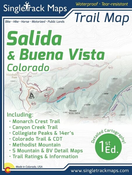
Singletrack Maps Salida & Buena Vista Trail Map

Details
Printed on waterproof & tear resistant paper for rugged toughness!
Map Details:
Trail Information and Ratings: Easy, Medium, Difficult
Scale 1:90,000 - 1in = 1.42 Miles or 1in = 2.2 Kilometers
Detailed Contour Lines. Contour Interval = 80ft
Measures 4” x 5.5” folded and 36” x 22” fully open
1st Edition - Printed in May 2022
Field Checked & Accurate!
Field checked cartography for the most accurate and up-to-date map available! We don’t rely on other parties for our data, we get outside and collect our own trail and geographic data.
Map Includes:
Monarch Crest Trail
South Fooses Creek Trail, Greens Creek Trail, Agate Creek Trail
Starvation Creek Trail, Silver Creek Trail, Rainbow Trail
Marshall Pass
S Mountain (Arkansas Hills)
Methodist Mountain
Buena Vista Midland Trail System
Broken Boyfriend
Vitamin B Trail
Fourmile Travel Management Area
Colorado Trail
Continental Divide Trail (CDT)
Canyon Creek Trail
Tunnel Lake Trail
Tomichi Pass, Hancock Pass, Williams Pass, Alpine Tunnel
Poplar Gulch Trail
Hope Pass Trail
Chinaman Gulch 4x4 Trail
Iron Chest 4x4 Trail
Iron Mike Mine 4x4 Trail
Twin Lakes
Cottonwood Pass
Aspen Ridge
Browns Canyon National Monument
See the Whole Picture
Stop staring at that tiny phone screen & see the entire landscape in one glance on this map! Beautiful and accurate cartography gives you the "big picture" view without having to scroll around on a 4" digital screen.
Local
Made in Colorado! From the cartography to the final printing. Every step takes place in Colorado. Buy Local!
Reviews