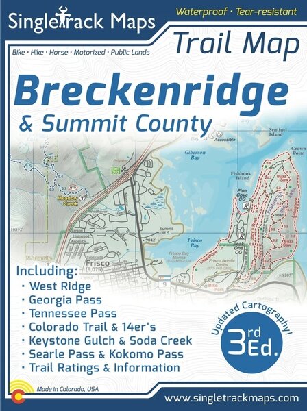
Singletrack Maps Breckenridge & Summit County Trail Map

Details
Designed for Hike, bike, horse, motorized, public lands, camping & more...
Printed on waterproof & tear resistant paper for rugged toughness!
?Map Details:
Trail Information and Ratings: Easy, Medium, Difficult
Scale 1:46,250 - 1in = 0.73 Miles or 1in = 1.17 Kilometers
Detailed Contour Lines. Contour Interval = 40ft
Measures 4” x 5.5” folded and 36” x 22” fully open
3rd Edition - Printed in July 2021
Map Includes:
?West Ridge
Georgia Pass?
Jefferson Creek Trail
Kenosha section of the CT
Colorado Trail
Soda Creek
Keystone Ranch
Frisco Peninsula
Eagles Nest Wilderness
Copper Mountain
Searle / Kokomo
Camp Hale
Tennessee Pass
Fremont Pass
14ers like Mt. Democrat
Cameron, Lincoln, Bross
Climax
Tenmile Range
Breckenridge
French Gulch
Gold Dust Trail
Como
and much more!
Also Includes;
Trail Mileage
Detailed Roads
Campground Information
Public Land Boundaries
Part Numbers
| MPN | Store SKU |
|---|---|
| 978-1-7923-7234-6 | BRE32458274P |
Reviews